 First published in The Jakarta Post, November 8, 2006
YUSUF SURACHMAN DJAJADIHARDJA: PREDICTING EARTHQUAKES AND TSUNAMIS
Alpha Amirrachman, Contributor, Jakarta
Two days after Pangandaran beach in West Java was hit by an earthquake, marine geologist Yusuf Surachman Djajadihardja was interviewed by a reporter from a national TV station.
"Pak Yusuf, can you predict where the next earthquake will strike?" asked the reporter.
"Probably in the waters off south Sumatra, the Sunda Strait, or in southern Java waters."
"Can you be more specific?"
"I think the Sunda Strait."
Within minutes the TV studio was being shaken. Later it was discovered that Sunda Strait was hit by an earthquake, sending tremors to Jakarta and surrounding areas.
That was a true story, and although it may have been a coincidence that the prediction was so accurate, Indonesia is undoubtedly going through a number of years of living dangerously, said Yusuf who is the Director of the Center of Technology for Natural Resource Inventory (P3TISDA) at the Agency for the Assessment and Application of Technology (BPPT).
In 1797, a massive 8.5 magnitude earthquake hit the Mentawai islands off Sumatra. Then, in 1815,Tambora volcano erupted in West Nusa Tenggara. In 1833, another earthquake struck Mentawai at a magnitude of between 8.7 and 9.0.
In 1861, an 8.5 magnitude earthquake occurred in Nias. And in 1883, the Krakatau volcano famously erupted.
In general, Yusuf said, Indonesia was rocked by massive earthquakes in 1350, 1600, 1797 and 1883, pointing to a certain cycle.
"So Indonesia is again undergoing a period of natural disasters in the 2000s," said Yusuf bluntly, during an interview with The Jakarta Post at his office on the 19th floor of the BBPT skyscraper.
He added that the Lapindo-mud disaster might also be an indication of the increased tectonic activity.
Earthquakes in this country are caused by a collision between the oceanic and continental crusts in the deep ocean, he said.
"But the tectonic zones in the eastern part of Indonesia and in the western part have different characteristics. In the western part, the Indo-Australia crust regularly collides with the Sumatra and Java plates, causing an oblique-subduction and creating what geologists call the Sumatra fault zone.
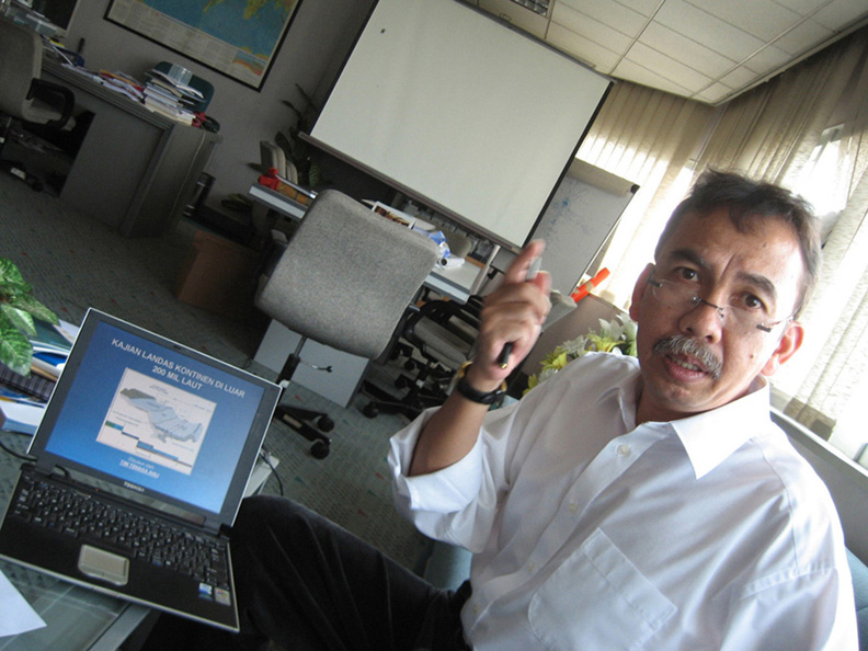
"And in the eastern part, the Australian plate is moving to the north, while simultaneously the Pacific plate is moving westward, squeezing the eastern part of Indonesia. These movements have resulted in a unique tectonic product," Yusuf depicted while gesturing and showing a simulation on his laptop.
So, will Australia and Indonesia eventually merge?
"Yes, but it's not as simple as that because there would be formation and deformation," said Yusuf.
Yusuf has been aware of the tsunami-prone areas since he joined an expedition conducted by the BPPT and the Japan Marine Science and Technology Center in 2002.
There were 15 researchers participating in the expedition including those from Trisakti University, the University of Indonesia, the Bandung Institute of Technology, Pertamina and the Institute for Marine and Fisheries Research (BRKP).
"I was praying, please God -- show me the richness of nature that You have created, anything that has not been discovered," Yusuf recalled.
Using a Japanese submersible Shinkai 6500, piloted by two Japanese team members, Yusuf and select members of the team successfully discovered the Sumatra fault at a depth of about 2,000 meters.
"I was amazed, we were all speechless. And we have since found five similar areas where we can draw a line for geological mapping," said Yusuf.
It was revealed that the Sumatra fault doesn't stop at Sunda Strait, but continues to the southern part of Sukabumi, West Java, a further 300 kilometers.
"This means the fault's total length is approximately 2000 kilometers from Sabang to the southern part of the waters off West Java encompassing Banten province," said Yusuf.
Based on findings announced during a press conference, Dec. 27, 2004 at the office of the State Ministry of Research and Technology, one day after Aceh was entirely devastated by a powerful earthquake-triggered tsunami, Yusuf predicted that there was a possibility that a similar tsunami would also hit the waters south of West Java.
His statement drew anger from those in the tourism industry who feared a loss of tourist revenue. Some scientists also disagreed with his statement.
Nevertheless, three months later, Nias was rocked by an 8.7 magnitude earthquake. And one and a half years later, Pangandaran beach was swamped by an earthquake-triggered tsunami, followed by another earthquake in Sunda Strait two days later.
Born Nov. 24, 1958 in Bandung, West Java, Yusuf first developed an interest in nature when he was still a young boy, skimming stones along the surface of a river in Bandung.
He received his undergraduate degree in geophysics and meteorology from the Bandung Institute of Technology in 1985. After completing his study, he was presented with the choices of joining Elnusa (then a sub-company of Pertamina) or the BPPT.
But he joined the latter in 1986 because "the building looked prestigious, it is located in the heart of Jakarta and I realized I would have good opportunities for further study."
After starting work, Yusuf shifted his specialization to marine geology. He was sent to Japan to continue his studies and completed both his masters and PhD in marine geology from Tokyo University in 1992 and 2003 respectively.
He said that two-thirds of Indonesia's sea is deep sea which has not been fully explored, adding that the deep sea has a lot of natural resource potential that can be used for the benefit of the nation, such as various minerals, oil, gas, and energy from methane hydrate.
Unfortunately, Indonesia has only six research ships; four owned by the BPPT and two by the Indonesian Research Institute (LIPI), "which are inadequate for a country as large as Indonesia."
Nevertheless, interest in research grew significantly after the catastrophe in Aceh, making many aware of the importance of marine geology and the vast potential and richness that the country's marine life offers.
Yusuf has been involved in various important research trips with international and national research institutes.
"And I would like to welcome more international researchers to collaborate with us, Indonesia's deep sea is a vast laboratory for curious researchers to discover," said Yusuf.
For example, the Java Trench is particularly intriguing because this is the deepest sea in Indonesia with a depth of 7,725 meters.
Some scientists predict that the area has 17.7 billion cubic meters of methane gas (CH4) which can be utilized as an alternative energy.
Yusuf, who is married to Rosita Gemala Hanum and has three children, has received awards from both the Marine and Fisheries Minister and the State Apparatus Minister for his devotion as a civil servant and achievements as a researcher respectively. And, he has had a fast rise through the civil servant ranks.
He was also awarded the Satyalancana Wira Karya Award from President Megawati Soekarnoputri for his dedication and a certificate from Jaya Suprana's Indonesia Record Museum (MURI) as the first Indonesian geologist to dive into the deep sea, both in 2003.
So, if Sumatra and Java are prone to earthquakes and the much-feared tsunami, where is the safest place in the country?
"Kalimantan island," quipped Yusuf, quickly adding that more research needs to be done to have more accurate geological mapping.
No comments:
Post a Comment